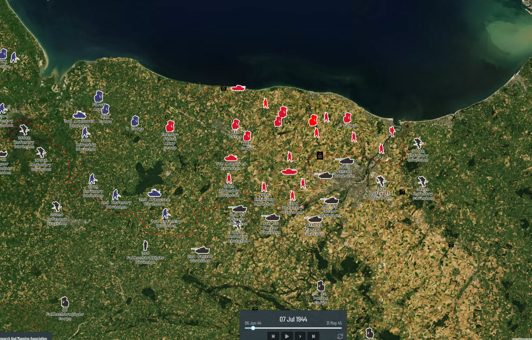
Project’44 – The Road to Liberation is an online web map that will let you explore WW2 like never before. Digitally preserved maps, aerial imagery and war diaries have been used to map out the Allied advance from the landings at DDay to the celebrations of VEDay.
Run & Organized by:
Over the past 2 years the Canadian Research and Mapping Association has been digitally preserving maps from Regimental museums and archives.
Aerial imagery of the Normandy front taken in 1946 is being supplied by IGN – Institute National de L’information Geogaphique et Forestiere.
Partnering with Library and Archives Canada all First Canadian Army (FCA) war diaries 1939-1945 are being digitized, and will be available on the web map.
Project ‘44 is funded in part by Veterans Affairs Canada. Together we thrive in the preservation and commemoration of Canadian Military History.
Excellent resource. I wish they would give Tom Mouat some money for using his dingbat images, though.
Excellent resource. I hope they paid/ will pay Tom Mouat for using his dingbat images, though.
Sorry, I take it back. I zoomed ahead to the beginning of the Scheldt Campaign and the German OOB is all wrong. Not only that, everything is superimposed on top of a modern map, which means that the coastline of Walcheren Island and the causeway from Beveland are completely different from what they were in 1944. That was just the first thing I bothered to check… too bad, obviously a lot of work went into this.
They should still pay Tom Mouat for use of his images, though.
Well we dont know if they did or did not. Or are you saying they did not?